

GeoServ, Inc.
Professional Experience
& Service
With Over 20 Years in the Business

GeoServ, Inc.
Has been involved in several dam removal projects related to fish passage and offers a highly qualified team of Geologists, Engineers, Environmental Planners and Drillers. Most of our dam removal projects have been in Northern California involving small dam structures on streams and wetlands. Services provided to assist clients with not only dam removal but also Vegetation Management, Wildland Fire, Hydro-power, Erosion and Storm-Water Control to Watershed/Channel Restoration for both Private and Federal agencies.
Erosion and Sedimentation
GeoServ, Inc. specializes in the development and implementation of SWPPPs.
We have experience working for the private and public sectors on a wide range of projects for road/building construction, vegetation management, wildland fire, hydropower, erosion, and stormwater control as well as watershed/channel restoration on lands managed by the private sector like tribes, local, state and federal government agencies.
Erosion and sedimentation is one of our specialties, this includes data collection, analysis and prevention. We have completed multiple erosion and sediment budget studies for watershed restoration, stream restoration, and nonpoint source runoff.

Site Investigation, Design and Construction
GeoServ, Inc. specializes in site investigation, design and construction using a variety of methods in order to preform simple and complex projects.
Most of our work is related to sites with unstable rock or soil conditions needing treatments beyond standard methods. We also help mitigate surface and groundwater problems. Common treatments include: over-excavating and re-compaction, drilling piers or piles, separation drains, topographic shaping and soil treatments.
GeoServ, Inc. also specializes in rock source development for rip rap, aggregate and sand. We frequently work with mines and quarries testing material quality, designing slopes and investigating new rock sources. We test for the rippability and compaction of native soils and engineered fill.

Rock, Soil, Water Investigation
We at Geoserv, Inc. complete analysis, design and construction of foundations, site characterization, tunnels, levees, landfills and other systems using geotechnical processes and tools.
We take care of the planning, permitting and technical reporting from our research which ranges from analytical and numerical study of geotechnical problems to constitutive modeling, experimental modeling and design.
GeoServ. Inc. offers common sense and cost effective Storm Water Pollution Prevention Plan (SWPPP) development; geologic and soils investigation and environmental assessments.
Quality Over Quantity Every Time!
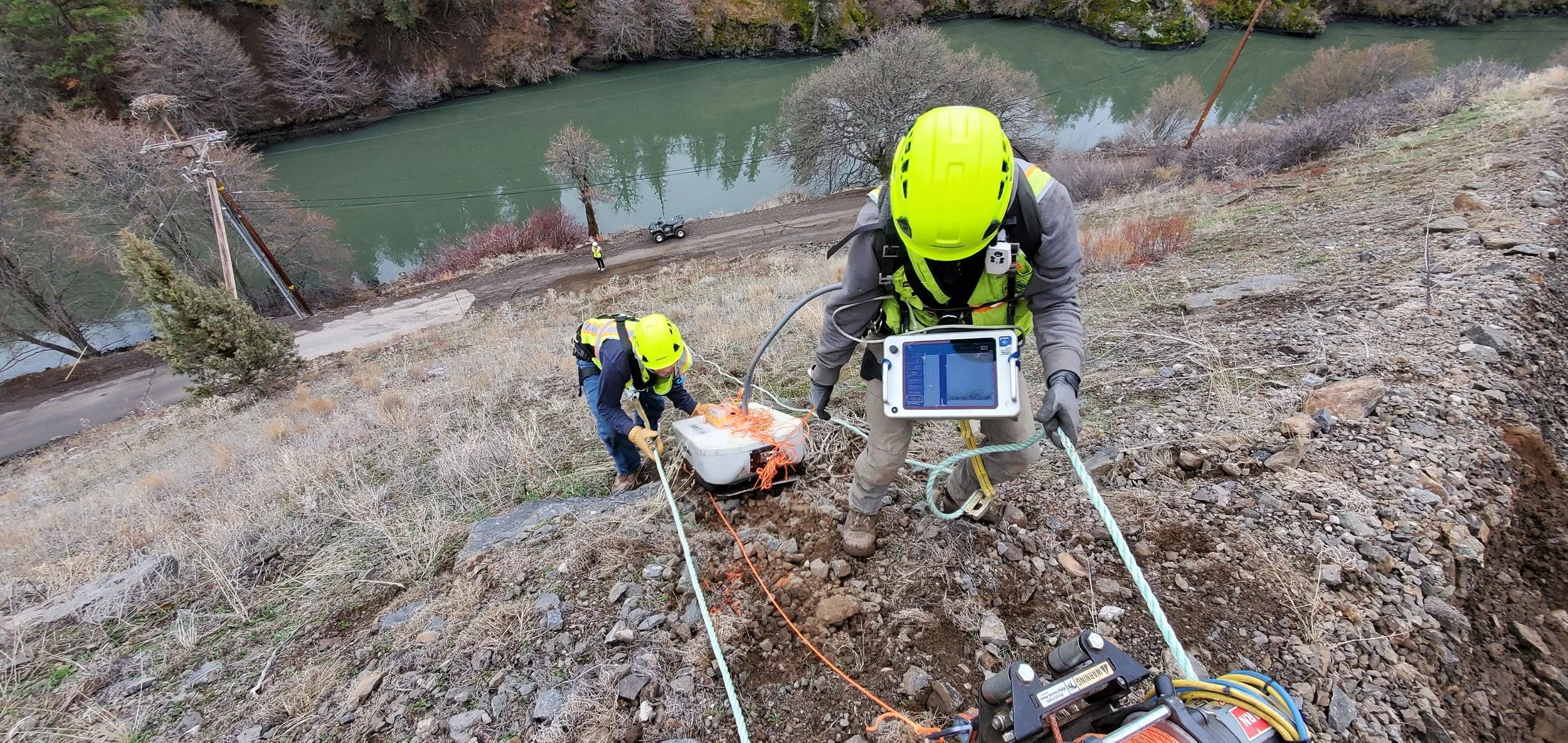
Subsurface Exploration & Well Drilling
Shallow and Deep Drilling (1’-1000’)
Rotary Auger, Air, Mud, and Core Drilling.
Geotechnical Investigation
Landslide Investigation
Road, Bridge and Culvert Investigation
Site Assessment
Ground-Water and Spring Monitoring
Geothermal Exploration
Minerals Exploration
Soil & Water Sampling
Monitoring Wells/Piezometers
Water Well Drilling.
Planning and Permitting
County Well Permits
Watershed and stream restoration
Private Timber Harvest Plan Professional Geologist Services
Storm Water Pollution Prevention Plan (SWPPP) and Water Pollution Control Plan (WPCP) Development (QSD)
Erosion and Scour Control Plans
Mine Reclamation Plan Development
Geologic and Soils Investigation
CEQA and NEPA Earth Science Specialist Input
401 Certifications and 404 Permit Preparation
California Department of Fish and Wildlife 1602 Permit Preparation
Environmental Assessment
Due Diligence Investigations
Phase 1 and All Appropriate Inquires
Phase 2 Site Assessment
Analysis and Design
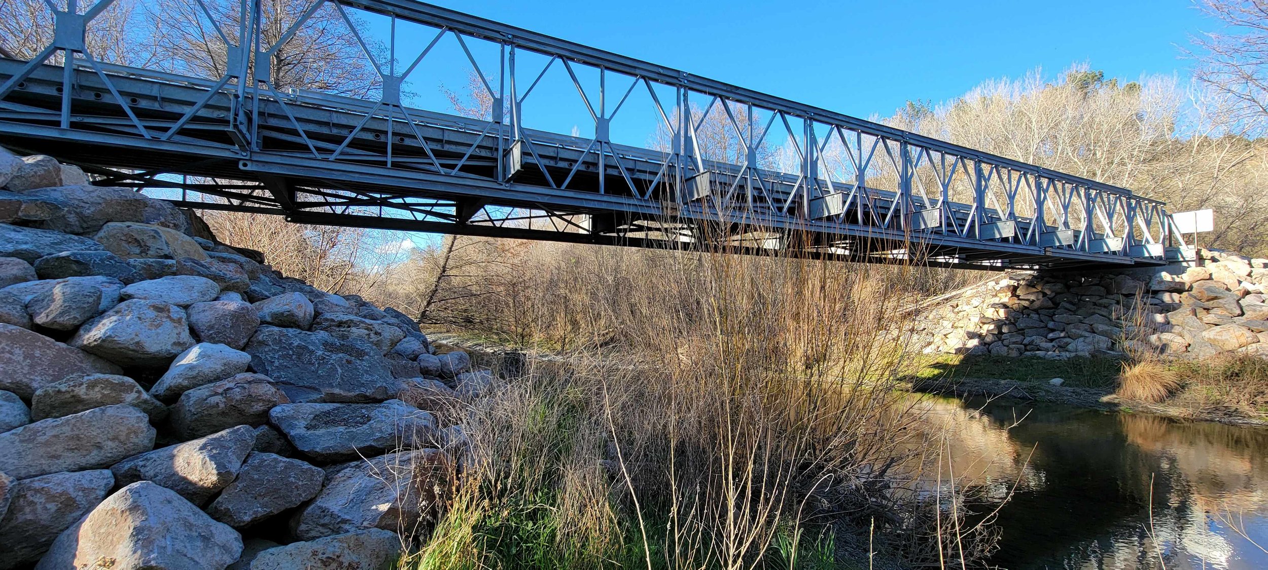
Dam, bridge, and culvert removal and upgrade
Excavatability and rippability analysis
Slope stability analysis and design
Stream channel and hillslope excavation and grading
Erosion and scour evaluation for structures
Surface water hydrology
Groundwater/seepage analysis and modeling
Dewatering – system, material, and equipment design
Suitability evaluation of earth construction materials
Seismic and ground motion analysis
Liquefaction analysis
Drafting and Design
Civil and grading plan development
General Civil3D Drafting
Surface and Sub-surface development and analysis
Technical Reporting
Technical reports, maps, drawings, photographs, and data appendices preparation
Technical report peer review
Mapping and Surveying
Investigation and pre/post project topographic surveys
Geologic and geomorphic surveys
Hydrologic and flood plain surveys
Landslide and scour surveys
Excavation and grading surveys
Wetland and stream side protection zone delineation and mapping
Sediment source inventory and road mapping
Road and dam fish passage inventory and mapping
Capable of Remote Site Access
Mapping and Survey Technology Includes: Total Station Survey, Survey Controller and Survey Pro, Trimble GPS Rover with TerraSync and ArcPad, RTK GPS Survey System, ArcMap GIS and AutoCAD
Technology capable of obtaining and processing LiDAR/photogrammetry data
Site Characterization
Surface and subsurface literature/map review
Aerial photography and remote sensing data review and interpretation
Surface hydrology and drainage conditions
Landslide, seismic, erosion, scour, flooding, and liquefaction hazards recognition and mapping
General and landslide subsurface exploration
Testing for engineering properties of rock, soil, and fill materials
Field classification of rock and soil
Groundwater well development
Geophysical surveys
Interpretation of geologic structure and processes
Construction Oversight, Inspection, Testing, and Monitoring
Groundwater and monitoring well drilling and geotechnical oversight
Engineered fill placement and compaction
Geologic conditions (e.g., trenches)
Groundwater control
Excavations (small and large)
Erosion control and re-vegetation
Storm Water Pollution Prevention Plan (SWPPP) Practitioner (QSP) and Water Pollution Control Plan (WPCP) inspection and monitoring
Stream channel and upland restoration
Stream and ditch flow gauge set up, maintenance, and calibration
Water quality monitoring
Laboratory testing – engineering classifications and analytical parameters
Laboratory testing durability wetting/drying and petrographic analysis
Rock, aggregate, sand, and soil quality investigation and testing
Ground and channel improvement/stabilization
Company Insurance
GeoServ, Inc. Carries a Minimum of one Million Dollars of General Liability, Professional Liability, Auto, and Worker Compensation
(2 million dollars aggregate) Insurance Policies